Photo by Chris Grafton on Unsplash
Transportation: Can You Get There from Here?
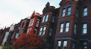
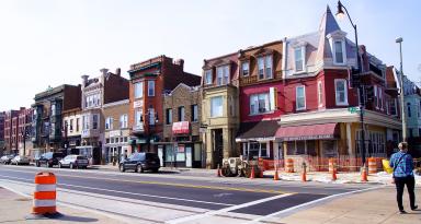
The Washington, D.C. area does pretty well in that respect, with its combination of the Metrorail system, highways and urban arteries, and numerous walkable and bikeable neighborhoods. Walk Score ranks Washington as the nation’s fifth most transit-friendly city, eighth among biking and sixth most walkable.
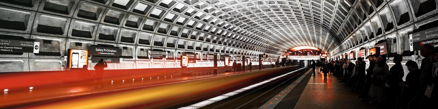
“We have a Metro system that is really effective for the people who are near it, and pretty usable for people elsewhere in the region,” explains Yonah Freemark, a senior research associate at the Urban Institute who studies transportation. The Washington area, he notes, “is one of the few regions of the country that actually has expanded the use of public transportation since the 1960s.”
Even so, a 2021 survey by the Metropolitan Council of Governments found that 72% of Washington area commuters rely on their own cars to get to work, while 19% utilize the Metrorail system. Another 13% walk to work, while 12% take the bus. Seven percent ride a bike to work, and 6% rely on carpools or vans, the same percentage that use taxis or rideshare services such as Uber and Lyft.
The survey also found that while 75% of District residents feel the region’s transportation system serves them well, satisfaction drops to 55% in Washington’s inner suburbs and 38% in the outer suburbs. Discontent about traffic congestion is higher in the suburbs as well, with 46% of residents of the inner suburbs and 54% of those in further-out communities describing traffic as a significant concern that impacts the quality of their lives, compared to just 27% of residents of DC’s urban core.
A 2021 study by INRIX, a transportation analytics company, found that while traffic in DC decreased during the pandemic, a typical DC-area commuter still wasted 44 hours per year sitting in traffic jams.
One problem, Freemark notes, is that not all Washington-area neighborhoods are equally accessible or commuter -friendly. Parts of Southeast DC and some fairly close-in suburbs — places such as Columbia Pike in Arlington and Mount Rainier in Prince George’s County — “have relatively high population densities, but just don’t have good access to the transit system,” he says. As a result, residents “are going to face larger barriers to getting to work and to other opportunities throughout the region.”
Race has emerged as a significant factor in mobility disparities as well, according to research by TransitCenter, a New York City-based organization that advocates for improving public transportation in cities. It reports that Washington, D.C.’s Black residents typically can reach 36% fewer job opportunities within a 45-minute transit trip than white residents.
Freemark thinks that more use of bicycles could help improve transportation, particularly in neighborhoods that are underserved by the transit system. “Those neighborhoods need better access to quality biking infrastructure,” he says. “That’s true both in DC and in the suburbs.” He’d like to see more protected bike routes in those places. Unless streets are made safer for cyclists in those areas, they’re going to continue to have to drive to get to their destinations, he says.
As the Washington, D.C. region’s population grows, some fear that traffic congestion will grow as well. One solution is to develop affordable housing close to existing Metrorail stations, according to Stewart Schwartz, executive director of the Coalition for Smarter Growth, an umbrella group of organizations that advocates for more walkable, bikeable, inclusive and transit-oriented communities.
Schwartz says that transit-oriented development is a win-win for residents. Even if housing near Metrorail tends to be more expensive than homes that are farther away from the region’s core, he points out that the overall expense for residents is lower once transportation costs are factored in.
Schwartz also wants to see planners focus on building “complete streets,” which are avenues designed for safe use by pedestrians and cyclists and not just car traffic.
As transportation activists see it, there’s no single, ideal solution. Instead, extending public transit—such as the planned Purple Line, a 16-mile route that will connect Bethesda with New Carrollton by 2026 — coupled with increased development around transit stations and improved biking and pedestrian routes, are moves that could work together to maintain and improve our mobility.
Last Updated: May 19, 2022